Maritime History
The Hawaiian archipelago has a long history of continuous and intensive maritime activity. Many historic shipwrecks and other types of submerged archaeological sites can be found in and around Hawaiian Islands Humpback Whale National Marine Sanctuary.
Polynesian Voyaging
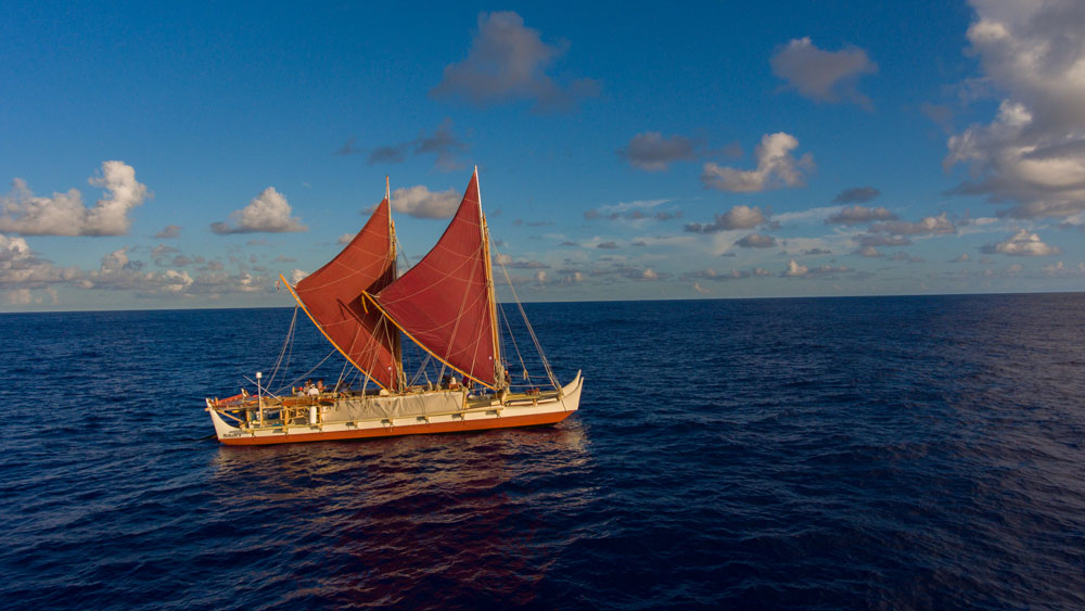
Over hundreds of years, double-hull voyaging canoes, guided by specialists raised in the art and science of non-instrument navigation, moved eastwards into the Pacific. The canoes carried the men and women and all necessary provisions needed for remote settlement. Navigators used solar and celestial observations of the sea, and swell direction and ocean temperature, to maintain their course beyond the sight of land.
The successful colonization of remote islands and atolls also relied on the technical capabilities of double-hulled oceanic voyaging canoes, or wa`a. These were advanced vessels, well designed for their environments. In a series of bold exploratory voyages, all of Eastern Polynesia appears to have been inhabited by around 700 CE. It is then from Eastern Polynesia, from Tahiti and the Marquesan Islands, that the remote corners of the Polynesian triangle, Rapa Nui (Easter Island), Aotearoa (New Zealand), and Hawai`i were originally discovered and settled.
The speed and carrying capacity of many types of Pacific canoes impressed 18th- and 19th-century observers such as Captain James Cook. The voyaging canoe design was clearly the preeminent Pacific vessel of ancient exploration and migration, a capable platform for colonizing remote islands and therefore of immense cultural importance.
Ocean Connection
Following Polynesian settlement, advanced aquaculture techniques flourished in the Hawaiian Islands, where there may have been between 400 and 500 stone fishponds producing around two million pounds of fish annually.
Fishponds are still some of the most significant traditional cultural resources in Hawai‘i. They demonstrate traditional capacity in sustainability, food sovereignty, and natural resource management. There is a continued interest in the repair and operation of traditional Hawaiian fishponds for their cultural, economic, and ecological value.
Shell fishing hooks, as well as scattered artifacts such as octopus lure weights, fish trap weights, and canoe anchors, are found on some near shore reefs, even in developed areas near Honolulu on the island of O‘ahu. Multiple ways of fishing continue to this day, including traditional methods like throw nets, torch fishing, and spears.
Western Contact
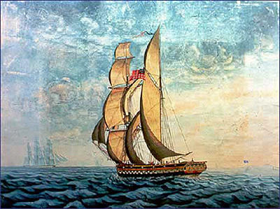
The wreck site of the brig Cleopatra's Barge highlights the interactions between Native Hawaiians and foreign cultures in the decades following Western contact. The luxurious 1816 vessel was sold to King Kamehameha II (Liholiho) in 1820 and renamed Ha‘aheo o Hawai‘i (Pride of Hawai‘i), to serve as the royal yacht.
Lost in 1824 in Hanalei Bay off Kaua‘i, the remains of Ha‘aheo o Hawai‘i were excavated in 1995. The collection is now on display at the Kaua‘i Museum in Līhuʻe. These and other Native Hawaiian, Asian, and Western artifacts in Hawai‘i tell the story of social and economic change among the islands.
Whaling Ships
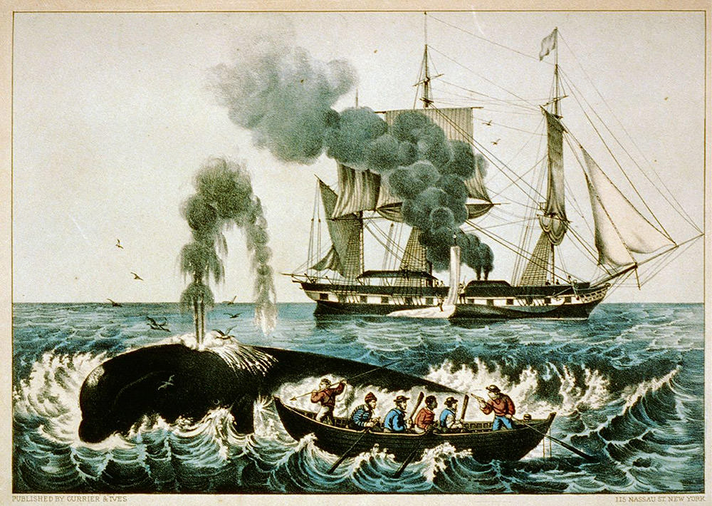
Soon after the crews of Balaena and Equator harpooned the first whale off Kealakekua Bay in 1819, Hawai‘i won its place on the maps of the whalers. Pacific whaling grounds became dominated by American vessels in the mid 19th-century, as whale oil became a major economic component of economic expansion in both New England and the Hawaiian Islands. Some residents in Hawai‘i today can trace their lineage to the frequent deserter from a whaling ship.
There are at least 18 documented whaling ship losses in and around the Hawaiian island chain, five of these reported historically within the sanctuary. The whalers Drymo (1845), Paulina (1860), and Young Hero (1858) were lost near Maui, Jefferson (1842) in Hanalei Bay on Kaua‘i, and Helvetius (1834) near O‘ahu. These shipwrecks testify to the once active and bloody American involvement in Pacific whale hunting.
Shipwreck Beach
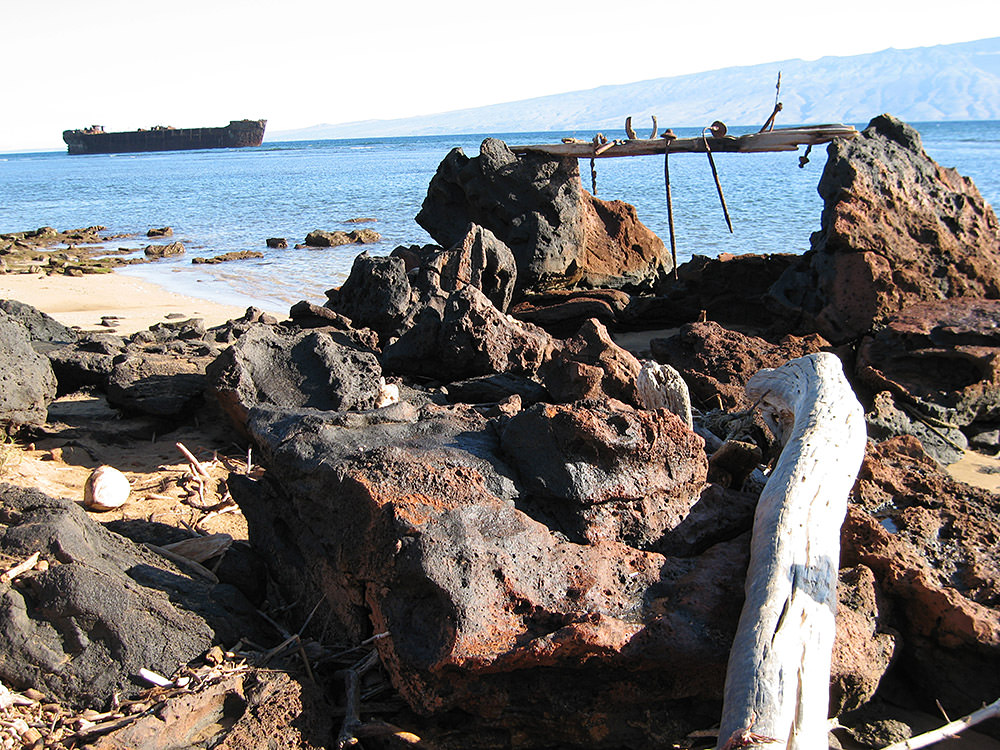
The sanctuary's boundaries also include “Shipwreck Beach” on the north shore of Lānaʻi. During the 19th and early 20th centuries, inter-island navigation companies used Shipwreck Beach as an area for the intentional abandonment of vessels, a “rotten row” of old ships. Other vessels were also lost on the coast's treacherous reefs by accident.
Several of these now historic sites have been surveyed, such as the Pearl Harbor survivor YO-21, the schooner Mary Alice and the Hawaiian steamship SS Hornet, but many other wrecks along the eight-mile stretch have yet to be identified.
Shipwreck Beach is also the location of a Hawaiian battleground. Seeking to strike against the political satellite of Maui, Kalaniʻōpuʻu, a war chief from the Island of Hawai‘i, landed his warriors along the north shore and raided Lānaʻi in 1778.
World War II
Unprecedented naval activity took place among the Hawaiian Islands during World War II, in the skies as well as on and under the sea. Hundreds of Navy fighter aircraft and pilots took part in intensive training activities in preparation for combat operations in the Pacific.
Over 1500 naval aircraft sank in the vicinity of the Hawaiian Islands, and of these some 39 are known to have been lost in sanctuary waters. Some of these submerged aircraft crash sites are war graves. Other submerged archaeological sites include landing craft and AMTRACKS (amphibious assault vehicles) lost during massive training exercises in the islands.
These protected resources, property of the federal government, bear witness to our nation's commitment and sacrifice during the war, a period which changed the shape of the entire Pacific region.
Dive Sites
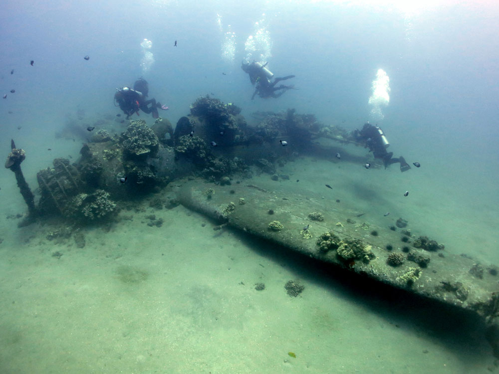
Shipwreck and aircraft sites within the sanctuary also function as sport diving destinations, enjoyed by local and visiting divers. The steamship SS Maui, lost on the Island of Hawai‘i, the F4U-1 Corsair in Oahu's Maunalua Bay, the PB4Y-1 Liberator near Maui, numerous U.S. Navy landing craft lost during training operations on beaches throughout the main Hawaiian Islands, and Carthaginian II, the replica whaling supply brig that once welcomed Lahaina visitors to tour on board, now entice divers to share a bit of the maritime past. The sport diving industry plays an important role in sharing the connection of Hawai‘i to the sea. You can read more about Maui's World War II Legacy.
Resources
Heritage resources within the sanctuary reflect the historical phases of past maritime activity: Native Hawaiian aquaculture and fishing, Pacific whaling, inter-island sail and steam navigation, and naval activity among the islands. Many of the maritime heritage resources within the sanctuary fall within state waters. The state agency for preservation management of these heritage resources is the State Historic Preservation Office under the Department of Land and Natural Resources, co-manager of the sanctuary.