Maps, Charts, and Geographic Information Systems Data
The sanctuary consists of five separate areas abutting six of the main islands in the state of Hawai‘i. The five areas of the sanctuary cover relatively shallow offshore areas built up from the sea floor by the development of the Hawaiian Island chain. Though underwater, the sanctuary actually lies near the summit of a massive undersea volcanic mountain range.
Maps
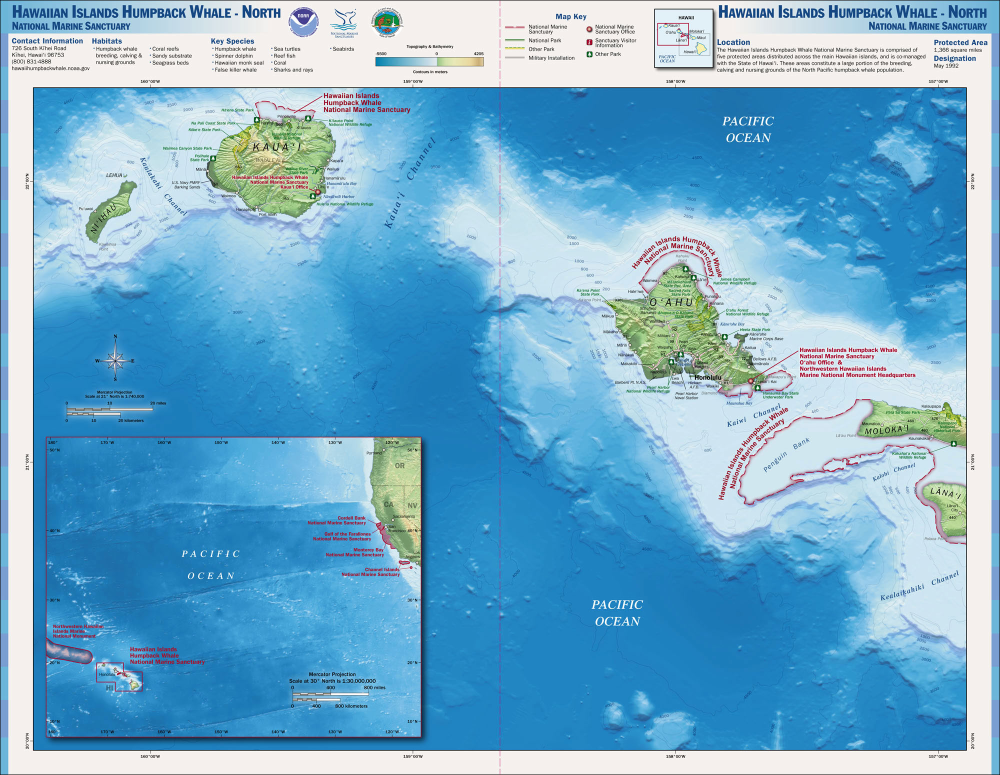
Ocean Depth with Sanctuary Boundary
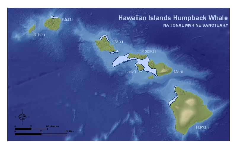
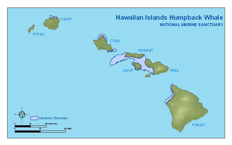
These maps show ocean depths around the main Hawaiian Islands and the boundaries of Hawaiian Islands Humpback Whale National Marine Sanctuary.
Marine Managed Areas Map
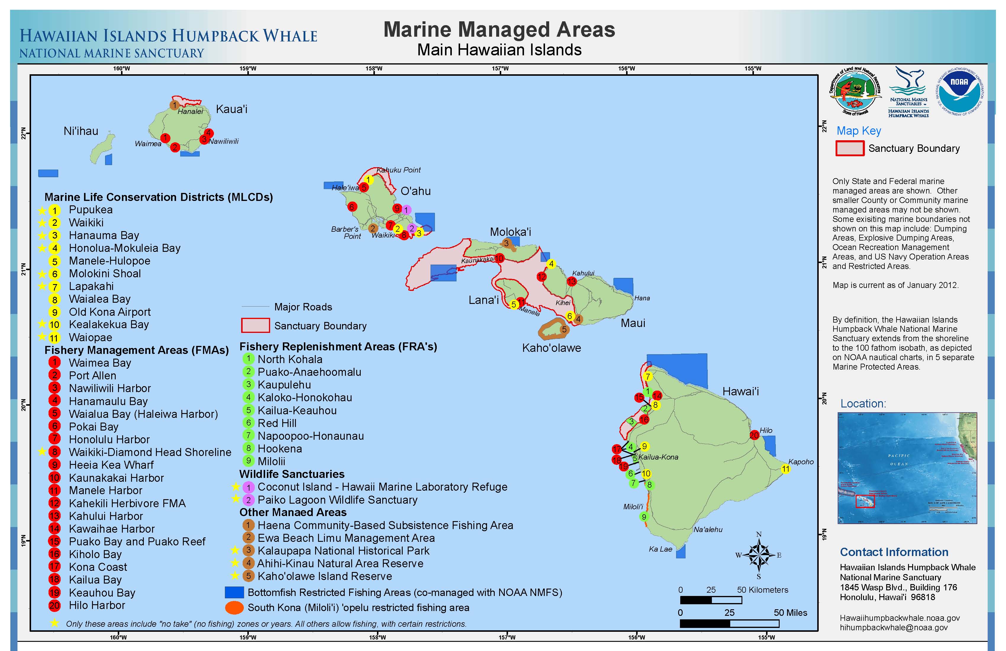
This map shows the various marine managed areas in the main Hawaiian Islands, including Marine Life Conservation Districts (MLCDs), Fishery Management Areas (FMAs), Fish Replenishment Areas (FRAs), Wildlife Sanctuaries, and Natural Area Reserves.
Humpback Whale Surface Sightings and Density Map
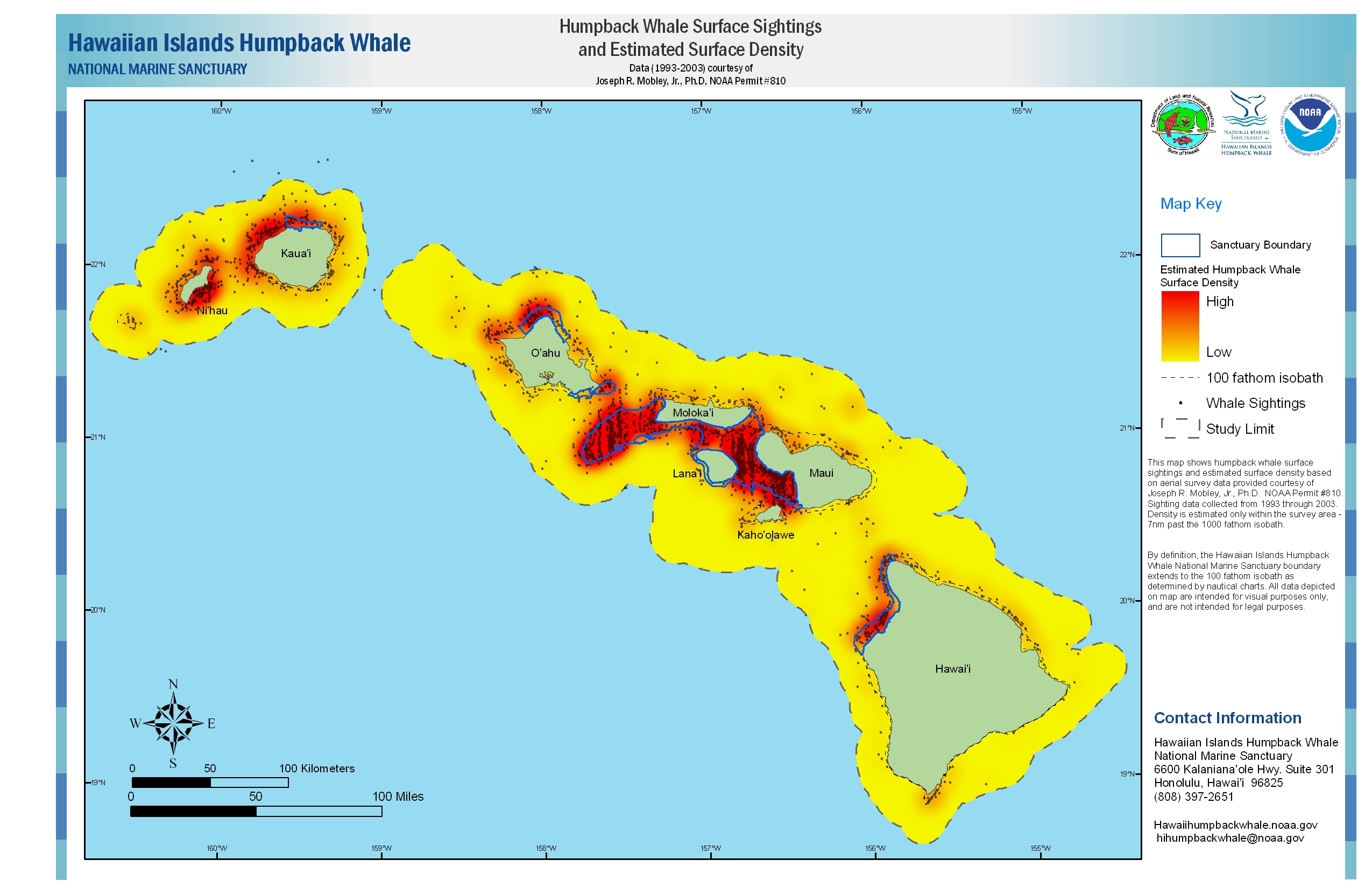
This map shows humpback whale surface sightings and estimated density for the main Hawaiian Islands. This data was taken from 1993 through 2003, courtesy of Joseph R. Mobley, Ph.D.
Atlas Maps of Sanctuary

These atlas maps show Hawaiian Islands Humpback Whale National Marine Sanctuary boundaries (Top image shows northern part and lower image shows southern part of the sanctuary).
NOAA Nautical Charts with Sanctuary Boundaries
The series of maps below show the sanctuary boundary on nautical charts. The charts should NOT be used for purposes of navigation. Click on the chart number to download a portable document format (pdf) of the chart.
Chart 19004 (pdf, 9.3 mb)
Nautical chart of the Hawaiian Islands and the full extent (1,370 sq. miles) of the sanctuary.
Chart 19327 (pdf, 10 mb)
Nautical chart of the West Coast of the island of Hawaii and the southeastern-most portion (150 sq. miles) of the sanctuary.
Chart 19347 (pdf, 13.7 mb)
Nautical chart of the channels between the islands of Moloka`i, Maui, Lana`i and Kaho`olawe, and the central portion (1,043 sq. miles) of the sanctuary.
Chart 19351 (pdf, 14.3 mb)
Nautical chart of the channels between the islands of O`ahu, Moloka`i, and Lana`i, and the central portion (1,043 sq. miles) of the sanctuary.
Chart 19357 (pdf, 11.6 mb)
Nautical chart of the island of O`ahu and the north (90 sq. miles) and south (47 sq. miles) O`ahu portions of the sanctuary.
Chart 19381 (pdf, 9 mb)
Nautical chart of the island of Kaua`i and the northeastern-most portion (40 sq. miles) of the sanctuary.
Geographic Information Systems (GIS) Data
NOAA Office of National Marine Sanctuaries GIS Data.
Online Chart Viewer
The Office of Coast Survey On-Line Chart Viewer allows mariners and the public to view NOAA charts.